Wednesday, August 18, 2010
Great Aussie Adventure - Day 16
I realize I forgot to include a photo of the Pajero the other day, so here it is now!!

After a night of steady downpours, the morning was bright and sunny! I stayed at the Dog Rock Motel and I wasn’t sure why it was called Dog Rock until I walked around and saw the rock. It totally does look like a dog!! Of course, it does help when you look at it from the correct direction.

I then headed toward Augusta (not the capital of Maine) and drove through Denmark on the way!! (Man, I sure did get lost a lot on this trip!) As I was driving and looking at my road atlas, I saw that there might have been another lighthouse that was not on the lighthouses of Australia website. So I thought I might as well check it out. I’m already running behind, so what is another side trip? On the way, I drove through several different national parks and forests. For a while, I thought I was in Redwood National Forest in California and was waiting for the Ewoks, or even Luke or Leia to pop out of the trees. But, no. Just huge trees!! (I should have remembered that when the road atlas shows a lighthouse, it’s usually a steel pole with a light bulb on top.) I stopped at the visitor center and saw a postcard with the lighthouse on it, so I continued. Driving through D’Entrecasteaux National Park, I was again reminded of California, Joshua Tree National Park this time. But I did make it to the Point D’Entrecasteaux Lighthouse. Much to my delight it was not a steel pole with a light bulb, but it was just a little thing. However, being in the National Park, the surrounding area was beautiful!


Leaving this National Park, I drove back through the area where Chewbacca and his pals hung out towards Cape Leeuwin and the lighthouse there. This is such an interesting spot as it the most south-westerly point in Australia and it is where the Southern and Indian Oceans meet. Awesome! I was eavesdropping and overheard the tour guide telling his group you can actually see where they meet!!! I hope from the video, I got it right! But this is also a cool lighthouse in addition to a great location! It was such a beautiful day and the water in both oceans was just amazing!
In the video, I said that this is the most SouthWesterly point in Oz, but it's actually the most SouthEasterly point in Australia. It still confuses me to have the Pacific Ocean on the East coast!! (And the beeping at the end is you Lisa, texting me!!)
Since this area is such a tourist attraction, there were several informative signs in the park. “When the Swan River Colony first set out to build a light at its southwest corner, the Eastern colonies rejected proposals to share the cost despite the fact it was agreed that a lighthouse was of importance to all ships heading past Cape Leeuwin. Following the gold rushes of the early 1890s, the Colony was able to fund the construction of a lighthouse itself. After extensive debate, Cape Leeuwin was chosen as the best location. The Cape Leeuwin Lighthouse was constructed in 1895/6. Several shipwrecks had been reported in the area after the first settlers arrived in 1830. In 1881 the Colonial Secretary noted the need for a light to mark landfall and danger to shipping.”
“The Cape Leeuwin Lighthouse was designed by the British Consultant Engineer, William Tregarthen Douglass, son of the famous Sir James Douglass. William had worked under his father as builder of the Eddystone … Lighthouse… The lighthouse was designed to have a tower elevation of 115 feet (35 meters) from base to focal plane height, with a range of light equal to 23 Nautical Miles, visible from a vessel’s deck. The foundation of the tower was laid 50 feet (16 meters) above the high water mark. The tower is over 105 feet tall (32 meters), supporting the lantern gallery above. Early designs incorporated a lower light to be located at the southern side of the tower. This was intended to direct a red light in the direction of the dangerous waters surrounding Cape Leeuwin, namely Alouarn Island, South East Rocks and Geographe Reef. The subsidiary light was intended to be visible seaward from a vessel’s deck at 14 miles (25 kilometers). However the Admiralty believed that the light would ‘entice mariners to approach the coast dangers‘ rather than repel them. The purpose-built lantern and lens array were instead installed at Bathurst Pt lighthouse at Rottnest Island, off the coast of Perth.”
“The light apparatus was installed in 1896...The apparatus consisted of a 12-foot lantern and 920mm focal radius rotating lens… The original lantern and rotating lens are still in use today, although the clockwork drive mechanism has been superceded by an electric motor and the original light source upgraded several times."


In 1955, a radio beacon was installed at the lighthouse. The light was manually operated until 1982, when it was converted to electricity. It was automated in 1992. The tower is 7 stories tall and has 186 steps. It is 56 meters (184 feet) above sea level, is 39 meters (128 feet) tall is visible for 26 Nautical Miles. The light flashes every 7.5 seconds.
“Three residences were built in 1895-9 to accommodate the three lighthouse keepers required for the continuous operation of the cape Leeuwin Lighthouse Station. Three keepers were considered necessary to fulfil the day-to-day operational duties and to assure efficiency in case of sickness or emergency. ‘Married quarters’ were provided to allow the keepers to maintain a normal family life. Each cottage had three bedrooms, a living room, kitchen, store and bathroom.. All three cottages were continuously occupied until 1988 and the last keeper to live in the cottage at Cape Leeuwin did so until 1998.’ (These are not typos - the last keeper left 12 years ago!!)
“The fourth cottage…accommodated the relief keeper who also collected firewood…In 1921 the relief keeper was withdrawn from service after a Government report suggested the fourth keeper was unnecessary. The house was demolished around 1928 and all that remains are its foundations.”

Since this is also where the two oceans meet, I’ve included some information about this from the signs as well. “Cape Leeuwin marks the point where the Indian Ocean meets the Southern Ocean. At various times of the year the differing ocean currents, waves and swell patterns are evident in the waters around the Cape. This can create unusual conditions in the nearby waters. The Antarctic Circumpolar Current circles Antarctica west to east, between 40 degrees and 70 degrees south. Its northern edge turns north and heads up along the western Australian coast. From May to September each year the Leeuwin Current transports warm tropical water southwards around Cape Leeuwin and along Western Australia’s southern coastline.”


Southern Ocean


Where two oceans meet


Indian Ocean
I left Cape Leeuwin and went to Cape Naturaliste. I was too late to get there for a tour, but I did see it from a distance. This area was home to at least 12 terrible shipwrecks between 1845 and 1907. The Cape Naturaliste Lighthouse is 100 meters (328 feet) above Geographe Bay was built in 1903. In 1904, the three lighthouse keepers quarters were added. In 1978, the light was automated and only 1 lighthouse keeper was kept on site. The light is painted with a special acrylic to match the original stone. The light flashes twice every 10 seconds, is 20 meters (66 feet) tall and is visible for 25 Nautical Miles. It is now 123 meters (404 feet) tall.


Another interesting thing of note, is the fireball that hit the tower in 1907. Ethel Baird, daughter of head light keeper Patrick Baird, describes the event: “It was 8.30am, a storm had been raging for 5 days, then it turned into a severe electric storm with terrible flashes of lightning and thunder which was deafening, then everything went quiet all of a sudden. We were standing looking out of the window facing North East, wondering if we could now go outside. It became very dark, then a large red ball of fire slowly appeared on the horizon. We watched it as it slowly moved towards us, the air became very warm. We were very frightened and then as it came closer, Mother quickly pushed we children under the beds. She got under a heavy dining room table, only just in time an the fire ball struck our house, breaking windows, the telephone rang violently, then it burst from the wall with a loud explosion, the noise was terrible. Mother became worried as Father was on duty up at the lighthouse. She put a coat on and rushed out leaving us screaming under the beds, to see if Father was safe. The pathway was all ripped up, to a depth of approximately 4' along the underground phone line from our house to the lighthouse. The wind was so strong that it almost knocked Mother over.
When she reached the lighthouse and went upstairs, on to the first landing, things were in a mess. Father said later that he put his hand on the phone to put through a weather report, and it blew up and out from the wall, knocking my Father unconscious. A long large cupboard, which was strongly bolted with long bolts to the wall, was blown from the wall. It had a lightning conductor running up the wall behind the cupboard from the ground to the top of the lighthouse dome and outside. This was twisted and torn. Everything was tossed and smashed up, that had been in the, path of the fire ball. It was terrible.
After the fire ball struck, there was loud thunder and lightning, like hell let loose for about an hour. Then the severity of the storm subsided and it became very quiet. Very heavy rain came down and lasted for a few hours, slowly stopping. Then everything cleared, the sun shone through and it looked so peaceful with raindrops glistening on trees and flowers.”
 Keepers Cottage
And right when I got there, the sun was going down, it was awesome! Some people heading back down the trail said there where whales out there, but it was still a bit of a walk and it was getting dark and I didn’t want to be out there and have to walk back in the dark, so I skipped seeing the whales. (It’s ok, I’ve seen them before.)


And I still needed to get a room for the night. Unfortunately, there is a golf tournament in this area over this long holiday weekend and the two towns where I was hoping to stay, had no rooms!!! Luckily, in the last place I asked, the people called around and found me a room, but it’s 90k’s from the lighthouses that I wanted to see when I got up. We’ll have to see if I can make it back there tomorrow or not. I also drove past 3 others in the dark, so I’m sure I’ll head back in the morning to see them. There is one that I really wanted to see, because I think it looked really cool. But I do need to get up early, so that is all I have to say tonight. Oh, I did forget to say that when I got to the hotel, there were 2 CSI forensics guys in a room across the hall! (Christine, there was Crime!!) But I was too tired and there really is no other rooms in this area and it was 9pm when I got here!

After a night of steady downpours, the morning was bright and sunny! I stayed at the Dog Rock Motel and I wasn’t sure why it was called Dog Rock until I walked around and saw the rock. It totally does look like a dog!! Of course, it does help when you look at it from the correct direction.

I then headed toward Augusta (not the capital of Maine) and drove through Denmark on the way!! (Man, I sure did get lost a lot on this trip!) As I was driving and looking at my road atlas, I saw that there might have been another lighthouse that was not on the lighthouses of Australia website. So I thought I might as well check it out. I’m already running behind, so what is another side trip? On the way, I drove through several different national parks and forests. For a while, I thought I was in Redwood National Forest in California and was waiting for the Ewoks, or even Luke or Leia to pop out of the trees. But, no. Just huge trees!! (I should have remembered that when the road atlas shows a lighthouse, it’s usually a steel pole with a light bulb on top.) I stopped at the visitor center and saw a postcard with the lighthouse on it, so I continued. Driving through D’Entrecasteaux National Park, I was again reminded of California, Joshua Tree National Park this time. But I did make it to the Point D’Entrecasteaux Lighthouse. Much to my delight it was not a steel pole with a light bulb, but it was just a little thing. However, being in the National Park, the surrounding area was beautiful!


Leaving this National Park, I drove back through the area where Chewbacca and his pals hung out towards Cape Leeuwin and the lighthouse there. This is such an interesting spot as it the most south-westerly point in Australia and it is where the Southern and Indian Oceans meet. Awesome! I was eavesdropping and overheard the tour guide telling his group you can actually see where they meet!!! I hope from the video, I got it right! But this is also a cool lighthouse in addition to a great location! It was such a beautiful day and the water in both oceans was just amazing!
In the video, I said that this is the most SouthWesterly point in Oz, but it's actually the most SouthEasterly point in Australia. It still confuses me to have the Pacific Ocean on the East coast!! (And the beeping at the end is you Lisa, texting me!!)
Since this area is such a tourist attraction, there were several informative signs in the park. “When the Swan River Colony first set out to build a light at its southwest corner, the Eastern colonies rejected proposals to share the cost despite the fact it was agreed that a lighthouse was of importance to all ships heading past Cape Leeuwin. Following the gold rushes of the early 1890s, the Colony was able to fund the construction of a lighthouse itself. After extensive debate, Cape Leeuwin was chosen as the best location. The Cape Leeuwin Lighthouse was constructed in 1895/6. Several shipwrecks had been reported in the area after the first settlers arrived in 1830. In 1881 the Colonial Secretary noted the need for a light to mark landfall and danger to shipping.”
“The Cape Leeuwin Lighthouse was designed by the British Consultant Engineer, William Tregarthen Douglass, son of the famous Sir James Douglass. William had worked under his father as builder of the Eddystone … Lighthouse… The lighthouse was designed to have a tower elevation of 115 feet (35 meters) from base to focal plane height, with a range of light equal to 23 Nautical Miles, visible from a vessel’s deck. The foundation of the tower was laid 50 feet (16 meters) above the high water mark. The tower is over 105 feet tall (32 meters), supporting the lantern gallery above. Early designs incorporated a lower light to be located at the southern side of the tower. This was intended to direct a red light in the direction of the dangerous waters surrounding Cape Leeuwin, namely Alouarn Island, South East Rocks and Geographe Reef. The subsidiary light was intended to be visible seaward from a vessel’s deck at 14 miles (25 kilometers). However the Admiralty believed that the light would ‘entice mariners to approach the coast dangers‘ rather than repel them. The purpose-built lantern and lens array were instead installed at Bathurst Pt lighthouse at Rottnest Island, off the coast of Perth.”
“The light apparatus was installed in 1896...The apparatus consisted of a 12-foot lantern and 920mm focal radius rotating lens… The original lantern and rotating lens are still in use today, although the clockwork drive mechanism has been superceded by an electric motor and the original light source upgraded several times."


In 1955, a radio beacon was installed at the lighthouse. The light was manually operated until 1982, when it was converted to electricity. It was automated in 1992. The tower is 7 stories tall and has 186 steps. It is 56 meters (184 feet) above sea level, is 39 meters (128 feet) tall is visible for 26 Nautical Miles. The light flashes every 7.5 seconds.
“Three residences were built in 1895-9 to accommodate the three lighthouse keepers required for the continuous operation of the cape Leeuwin Lighthouse Station. Three keepers were considered necessary to fulfil the day-to-day operational duties and to assure efficiency in case of sickness or emergency. ‘Married quarters’ were provided to allow the keepers to maintain a normal family life. Each cottage had three bedrooms, a living room, kitchen, store and bathroom.. All three cottages were continuously occupied until 1988 and the last keeper to live in the cottage at Cape Leeuwin did so until 1998.’ (These are not typos - the last keeper left 12 years ago!!)
“The fourth cottage…accommodated the relief keeper who also collected firewood…In 1921 the relief keeper was withdrawn from service after a Government report suggested the fourth keeper was unnecessary. The house was demolished around 1928 and all that remains are its foundations.”

Since this is also where the two oceans meet, I’ve included some information about this from the signs as well. “Cape Leeuwin marks the point where the Indian Ocean meets the Southern Ocean. At various times of the year the differing ocean currents, waves and swell patterns are evident in the waters around the Cape. This can create unusual conditions in the nearby waters. The Antarctic Circumpolar Current circles Antarctica west to east, between 40 degrees and 70 degrees south. Its northern edge turns north and heads up along the western Australian coast. From May to September each year the Leeuwin Current transports warm tropical water southwards around Cape Leeuwin and along Western Australia’s southern coastline.”


Southern Ocean


Where two oceans meet


Indian Ocean
I left Cape Leeuwin and went to Cape Naturaliste. I was too late to get there for a tour, but I did see it from a distance. This area was home to at least 12 terrible shipwrecks between 1845 and 1907. The Cape Naturaliste Lighthouse is 100 meters (328 feet) above Geographe Bay was built in 1903. In 1904, the three lighthouse keepers quarters were added. In 1978, the light was automated and only 1 lighthouse keeper was kept on site. The light is painted with a special acrylic to match the original stone. The light flashes twice every 10 seconds, is 20 meters (66 feet) tall and is visible for 25 Nautical Miles. It is now 123 meters (404 feet) tall.


Another interesting thing of note, is the fireball that hit the tower in 1907. Ethel Baird, daughter of head light keeper Patrick Baird, describes the event: “It was 8.30am, a storm had been raging for 5 days, then it turned into a severe electric storm with terrible flashes of lightning and thunder which was deafening, then everything went quiet all of a sudden. We were standing looking out of the window facing North East, wondering if we could now go outside. It became very dark, then a large red ball of fire slowly appeared on the horizon. We watched it as it slowly moved towards us, the air became very warm. We were very frightened and then as it came closer, Mother quickly pushed we children under the beds. She got under a heavy dining room table, only just in time an the fire ball struck our house, breaking windows, the telephone rang violently, then it burst from the wall with a loud explosion, the noise was terrible. Mother became worried as Father was on duty up at the lighthouse. She put a coat on and rushed out leaving us screaming under the beds, to see if Father was safe. The pathway was all ripped up, to a depth of approximately 4' along the underground phone line from our house to the lighthouse. The wind was so strong that it almost knocked Mother over.
When she reached the lighthouse and went upstairs, on to the first landing, things were in a mess. Father said later that he put his hand on the phone to put through a weather report, and it blew up and out from the wall, knocking my Father unconscious. A long large cupboard, which was strongly bolted with long bolts to the wall, was blown from the wall. It had a lightning conductor running up the wall behind the cupboard from the ground to the top of the lighthouse dome and outside. This was twisted and torn. Everything was tossed and smashed up, that had been in the, path of the fire ball. It was terrible.
After the fire ball struck, there was loud thunder and lightning, like hell let loose for about an hour. Then the severity of the storm subsided and it became very quiet. Very heavy rain came down and lasted for a few hours, slowly stopping. Then everything cleared, the sun shone through and it looked so peaceful with raindrops glistening on trees and flowers.”
 Keepers Cottage
And right when I got there, the sun was going down, it was awesome! Some people heading back down the trail said there where whales out there, but it was still a bit of a walk and it was getting dark and I didn’t want to be out there and have to walk back in the dark, so I skipped seeing the whales. (It’s ok, I’ve seen them before.)


And I still needed to get a room for the night. Unfortunately, there is a golf tournament in this area over this long holiday weekend and the two towns where I was hoping to stay, had no rooms!!! Luckily, in the last place I asked, the people called around and found me a room, but it’s 90k’s from the lighthouses that I wanted to see when I got up. We’ll have to see if I can make it back there tomorrow or not. I also drove past 3 others in the dark, so I’m sure I’ll head back in the morning to see them. There is one that I really wanted to see, because I think it looked really cool. But I do need to get up early, so that is all I have to say tonight. Oh, I did forget to say that when I got to the hotel, there were 2 CSI forensics guys in a room across the hall! (Christine, there was Crime!!) But I was too tired and there really is no other rooms in this area and it was 9pm when I got here!
 Labels:

Saturday, August 14, 2010
Great Aussie Adventure - Day 15 - State 4!!
It was rainy and cool when I woke up this morning in Mundaring. I drove for 5 hours Southeast to Albany (not the Capital of New York) as there are 3 lighthouses here, the lighthouses of the Great Southern Coast. My plan was to see the lighthouses in the National Park quickly and then head North toward Augusta so I could see the lighthouses there tomorrow. However, since this is the long weekend (Monday is the Queen’s birthday) and it’s motor cross this long weekend, so everywhere is booked. The last place I could find is actually in Albany in an executive room, but since I wanted a place to sleep tonight, the Pajero is big enough for me to sleep in, but I also wanted a shower, so here I am! But it’s great! Albany has an old navy ship, The Brig Amity. It’s pretty cool, but because of the rain, I didn’t walk on it. From here I headed to Torndirrup National Park to find the lighthouses. I stopped at a pretty beach called Cable Beach. But again, I didn’t get out because of the rain. But again I didn't get out because of the rain.


Anyway, I thought that I would only be able to see one lighthouse here, (I know a 5 hour drive for 1 lighthouse?, but it payed off.) I was able to see all 3!!! I saw Cave Point Lighthouse first, but from a distance, as the road to it is closed.


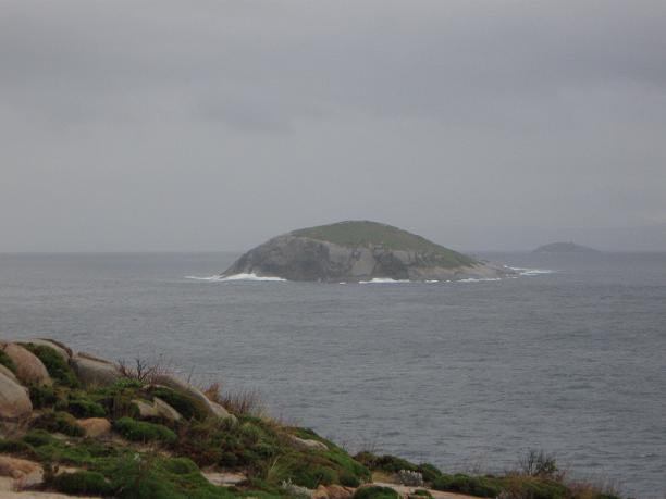
From here, I could see Eclipse Island Lighthouse, but from a further distance because it’s on an Island. This lighthouse was built in 1926 as a manned kerosene light. This was the first Commonwealth lighthouse to be built in Western Australia. This lighthouse is 119 meters (390 feet) above sea level, is 14 meters (46 feet) tall and is visible for 15 Nautical Miles. The light flashes 3 times in 12 seconds and has been solar powered since 1976 when the lantern room was removed to install a beacon.


I drove through Torndirrup National Park a bit more and stumbled upon Breaksea Island Lighthouse. Again from a distance, because it’s on an island. But it was a good day, 3 lighthouses, I’m no longer going through withdrawals!!


In Torndirrup National Park, there is a Gap and a Natural Bridge. A bit of background first. The continents of Australia and Antarctica were bound together along this rugged coastline for more than one billion years, forming part of the super-continent Gondwana. The ancient continents were formed mainly of gneiss (sounds like “nice“) a rock created deep in the Earth‘s crust. Pressure and friction at the base of the two fused continents caused rock to melt and slowly rise up through the gneiss. This molten rock slowly cooled, hardening into granite and helping to cement the continents together. Australia and Antarctica separated about 45 million years ago when the last sections of the super-continent broke apart. The rocks where you now stand were left behind when the continents parted. Today, rock formations on Australia‘s southern coast can still be matched to identical rocks on the northern coast of Antarctica near Windmill Islands. Still drifting to the north, Australia is 5 centimetres further from Antarctica than it was one year ago today!
The granite which forms the Gap and the Natural Bridge was created when molten rock rose from deep in the earth‘s crust. It hardened 20 kilometres below what was then the surface. Water and wind wore and eroded away the softer layers of rock which lay above the granite. No longer held down by this weight, the granite expanded and cracked as it slowly rose to become exposed at the surface. Driven by wind and waves, water and air pressure wore open the cracks, quarrying the granite into block shaped sections. Waves relentlessly pounded against the coast, eventually tearing away loose blocks of granite to create the gap and the Natural Bridge. Sometime in the future… the Gap will widen and disappear…the Natural Bridge will collapse and become a new Gap.


The Gap and The Natural Bridge


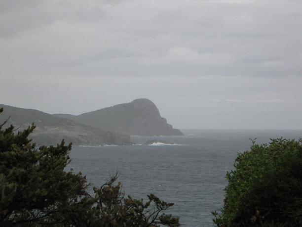
Anyway, I thought that I would only be able to see one lighthouse here, (I know a 5 hour drive for 1 lighthouse?, but it payed off.) I was able to see all 3!!! I saw Cave Point Lighthouse first, but from a distance, as the road to it is closed.


From here, I could see Eclipse Island Lighthouse, but from a further distance because it’s on an Island. This lighthouse was built in 1926 as a manned kerosene light. This was the first Commonwealth lighthouse to be built in Western Australia. This lighthouse is 119 meters (390 feet) above sea level, is 14 meters (46 feet) tall and is visible for 15 Nautical Miles. The light flashes 3 times in 12 seconds and has been solar powered since 1976 when the lantern room was removed to install a beacon.


I drove through Torndirrup National Park a bit more and stumbled upon Breaksea Island Lighthouse. Again from a distance, because it’s on an island. But it was a good day, 3 lighthouses, I’m no longer going through withdrawals!!


In Torndirrup National Park, there is a Gap and a Natural Bridge. A bit of background first. The continents of Australia and Antarctica were bound together along this rugged coastline for more than one billion years, forming part of the super-continent Gondwana. The ancient continents were formed mainly of gneiss (sounds like “nice“) a rock created deep in the Earth‘s crust. Pressure and friction at the base of the two fused continents caused rock to melt and slowly rise up through the gneiss. This molten rock slowly cooled, hardening into granite and helping to cement the continents together. Australia and Antarctica separated about 45 million years ago when the last sections of the super-continent broke apart. The rocks where you now stand were left behind when the continents parted. Today, rock formations on Australia‘s southern coast can still be matched to identical rocks on the northern coast of Antarctica near Windmill Islands. Still drifting to the north, Australia is 5 centimetres further from Antarctica than it was one year ago today!
The granite which forms the Gap and the Natural Bridge was created when molten rock rose from deep in the earth‘s crust. It hardened 20 kilometres below what was then the surface. Water and wind wore and eroded away the softer layers of rock which lay above the granite. No longer held down by this weight, the granite expanded and cracked as it slowly rose to become exposed at the surface. Driven by wind and waves, water and air pressure wore open the cracks, quarrying the granite into block shaped sections. Waves relentlessly pounded against the coast, eventually tearing away loose blocks of granite to create the gap and the Natural Bridge. Sometime in the future… the Gap will widen and disappear…the Natural Bridge will collapse and become a new Gap.


The Gap and The Natural Bridge




Great Aussie Adventure - Day 14

Today when I got up, there were no plans (I think it’s June 4th). So I walked around The Rundle Mall in Adelaide before I had to go to the airport. I dropped of the Getz and got on a plane to Perth. Our plane was delayed for about 30 minutes. There was a lady who checked her bags and then didn’t board the plane. They had to get her bags off the plane before we could take off. The airlines are not permitted to fly if someone’s bags are on board but the person isn’t - security reasons. Apparently, she then showed up 20 minutes after we were supposed to have taken off and they were searching for her bag to remove it, but they didn’t let her on because the doors were already closed. So we left without her! The flight was a bit turbulent, but I landed in Perth 30 minutes after we were supposed to, so it all worked out. As I was leaving the Perth airport, the sunset was just beautiful, all pink and purple and orange. I got to my hotel and I was able to get the fireplace going in the cabin. It was either that or freeze!! My mode of transportation this time is a Mitsubishi Pajero and it’s huge!!! It’s bigger than my 4Runner was and I am a bit intimated to be driving it, but I need 4wheel drive here. Luckily I didn’t have to drive through Perth to get to my hotel and for the next 4 days I’ll be seeing lighthouses and I’ll get used to it! But I think it’ll be fun!! Two days without seeing a lighthouse on my lighthouse tour - not good!!! I believe I’m going through withdrawals!
Tuesday, August 10, 2010
Great Aussie Adventure - Day 13
Well today was sunny and cool again!! I left Port Augusta, as there isn't much to see there. I drove 4 hours to Adelaide along the highway. Just more mountains and nice scenery. In North Adelaide, there is a Big Thing, it’s the Scotsman at Scotty’s Hotel.

 The City of Churches
 Adelaide Museum
 South Australia's School of Medicine
 Just a really pretty house
 The South Australia Flag
While in Adelaide I walked around the city center a bit. I had a nice dinner and went to bed early. (Tomorrow is the flight to Perth, Western Australia.) While driving in SA, I passed Mount Laura on the way to Port Lincoln and a town called Laura on the way back to Adelaide, and there’s a Laura Bay which is East of Port Augusta on the way to Perth, but I didn’t see this since I’ll be flying over the area!! They love me in South Australia!!!!

 The City of Churches
 Adelaide Museum
 South Australia's School of Medicine
 Just a really pretty house
 The South Australia Flag
While in Adelaide I walked around the city center a bit. I had a nice dinner and went to bed early. (Tomorrow is the flight to Perth, Western Australia.) While driving in SA, I passed Mount Laura on the way to Port Lincoln and a town called Laura on the way back to Adelaide, and there’s a Laura Bay which is East of Port Augusta on the way to Perth, but I didn’t see this since I’ll be flying over the area!! They love me in South Australia!!!!
Monday, August 9, 2010
Great Aussie Adventure - Day 12
 The view from my hotel!!
Oh my gosh, I woke up today in Port Lincoln and the sun was out and it was kind of warm!! It was actually a beautiful day!!! I went to Lincoln National Park and saw Cape Donington Lighthouse.


And the national park was lovely on the water and everything. There is even a salt lake called Pillie Lake!


Viking Ship cloud Pillie Lake
I saw several emus again, but no kangaroos today. I stopped at the Old Mill in Port Lincoln after leaving the national park. According to a sign at The Old Mill, “Built in 1846, this popular landmark is the oldest standing building in Port Lincoln. It has featured in paintings, photographs and been fondly remembered by visitors to the town.
The foundation stone was laid on 20th April 1846 by Dr Lawson of Port Lincoln. The population of the town was around 89 people. Like many towns, its fortunes had fluctuated, and the proposal of a windmill was popular with the local population. Hand grinding flour was a laborious process and the windmill was seen as an added draw-card for attracting potential settlers to the town. Supply vessels from Adelaide were often subject to delays due to rough weather and a larger, more self-sufficient population was hoped for…
It is not certain why the mill was never completed by the syndicate. It is know that the machinery had been purchased and three internal wooden floors and shaft were installed. A probable explanation was that there was a shortage of wheat grain in the area. The sale of small lots of land to potential farmer settlers had been hampered by the high prices demanded by speculators owning Special Survey Sections.
Along with this was a slowed growth rate in population and possibly a cheaper and easier method of grinding flour available. By 1854, the mill was described as an ‘unfinished ruin for the last five years’ by the Government Reports on Mills in South Australia.
Miss Amy Bishop donated the mill and land to the City of Port Lincoln in 1946. The mills fortunes changed when The Port Lincoln Pioneer and Descendants Club needed a place to permanently display their historic items and saw the potential in the old ruin. The Club lovingly repaired the mill for use as a museum. It was opened on 25th January 1964 as the Old Pioneer Mill Museum and immediately became a popular attraction for many years.
A wrought iron spiral stairway was added to allow access to the roof. This gift from the Bishop Estate Progress Association increased the attraction of the mill as a favoured viewing position of the panoramic views of Boston Bay and beyond…”


On the way back out of Port Lincoln, I drove through Boston Township, so I had to stop and take a photo of the Boston House. On the drive, the scenery was just beautiful. The fields were so green, the sky was so blue and the ocean even was bluer!! Not to mention the white puffy clouds. It was just beautiful!


I ended up in Port Augusta where I am spending the night. From here it is another 4 hours to Adelaide and I was too tired to keep driving. (Plus the ferry is no longer in use!!) Port Augusta is the 'Crossroads of Australia' as it 'bridges the Outback and the Sea'. At one round-a-bout, there is a road sign that points to Alice Springs, Darwin, Perth and Adelaide. For some reason, I just found this cool. I must be right in the middle of Australia, just on the south coast!! Oh and another thing, driving along the peninsulas or even in Tas and Vic, people wave as they are driving. Not a big crazy wave, just raising their hand off the steering wheel or pointing as a hello. It’s all very friendly. (Wish you were here Chris, you’d fit right in being from Kansas and all!!!) After today, I have seen all the South Australia Lighthouses that I can see. There is one that was demolished. Another one is inaccessible, but the top is the at Port Adelaide. And then of course, there are the 4 on Kangaroo Island that I skipped!
Subscribe to:
Posts (Atom)
About Me

- Laura
- Denver, Colorado, United States
- I'm originally from Colorado, but I've been living in Australia for three years. Before that, I lived all over the U.S.: Washington State, Maine, California, Oregon, Nebraska, North Carolina, Arizona, New Mexico, Pennsylvania, and more... No, I'm not a military brat or a military wife; I was a traveling nurse for 5 years so I moved to a new city every 3 months. During my travels, I became intrigued with lighthouses and started making plans to photograph as many as I could in whichever state I was living (including the two in Nebraska!) My blog is about my trips to various lighthouses, as well as other interesting trips. I hope you enjoy reading, and leave a comment or two!