Showing posts with label Lighthouse. Show all posts
Showing posts with label Lighthouse. Show all posts
Tuesday, February 8, 2011
Great Aussie Adventure - Day 23
This morning was again cloudy and overcast as I headed to Port Samson and the lighthouse there. This lighthouse is Jarman Island Lighthouse and as the name suggests, is out on an island! But I was able to get a few photos of it!


This lighthouse was built in 1888. It is 99 meters (324 feet) above sea level and stands 15.5 (50.5 feet) tall. It was deactivated in 1985. It is one of two segmented cast iron sea lights in WA. The pre-fabricated cast iron tower was imported from England. This towers was established as a way of getting lights to remote places. Lighthouse construction was at a point, that in 1887, entire lighthouses could be packed and shipped from England for erection in Australia. However, the lens was shipped separately. The tower body of the lighthouse is composed of cast iron plates, a little more than 28mm (1 inch) thick, bolted on the inside so the exterior would be smooth. This type of construction was developed, so that salt laden aerosols or spray would not cause corrosion at the joints. Even the tools and paint were shipped with the lighthouse from England.


The original light was a flashing second order lantern with a four wick Douglas burner and kerosene oil. In 1910, the lamp was replaced with a 55mm (1 ¾ inch) incandescent lamp using vaporised kerosene. It was again upgraded in 1917, to an AGA acetylene gas lamp activated by a sunvalve. The lighthouse was painted red and white. Steel ladders and landings provided internal access to the lantern room.
The area was first visited by Captain Jarman on the ship “Tien Tsin”. The island was named after Captain Jarman and the town was originally named after the ship. The island is the entry to the old abandoned Port of Cossack and the wharves at Point Samson. However, by 1902, due to the silting up of the tidal estuary, the port was no longer usable. And in 1904, a new jetty was built at Point Samson which took over as the functional port. In 1960, Cape Lambert/Port Walcott became the viable port for oversea iron ore carriers. Between 1922 & 1941, the island was used as holiday getaways. But in the 1950’s, the lighthouse quarters and building were abandoned. The lighthouse was turned off for good in 1985 with the construction of the Cape Lambert Lighthouse. The island itself is approximately 16 ha.
And then the 9 hour drive to Broome! I stopped in Port Hedland and the sun came out!! Then the rest of the drive (in the red dirt again!) was sunny.


The high again was 28°C (82°F). I’ve included a few photos as I stopped along the way so you can see what I mean about the red dirt!
I stopped along the way as the sun was going down and it was an amazing sunset!!


Then I got to Broome in the dark, AGAIN!! But to my delight, there is a lighthouse that I can see here in the morning, Yahoo!!


This lighthouse was built in 1888. It is 99 meters (324 feet) above sea level and stands 15.5 (50.5 feet) tall. It was deactivated in 1985. It is one of two segmented cast iron sea lights in WA. The pre-fabricated cast iron tower was imported from England. This towers was established as a way of getting lights to remote places. Lighthouse construction was at a point, that in 1887, entire lighthouses could be packed and shipped from England for erection in Australia. However, the lens was shipped separately. The tower body of the lighthouse is composed of cast iron plates, a little more than 28mm (1 inch) thick, bolted on the inside so the exterior would be smooth. This type of construction was developed, so that salt laden aerosols or spray would not cause corrosion at the joints. Even the tools and paint were shipped with the lighthouse from England.


The original light was a flashing second order lantern with a four wick Douglas burner and kerosene oil. In 1910, the lamp was replaced with a 55mm (1 ¾ inch) incandescent lamp using vaporised kerosene. It was again upgraded in 1917, to an AGA acetylene gas lamp activated by a sunvalve. The lighthouse was painted red and white. Steel ladders and landings provided internal access to the lantern room.
The area was first visited by Captain Jarman on the ship “Tien Tsin”. The island was named after Captain Jarman and the town was originally named after the ship. The island is the entry to the old abandoned Port of Cossack and the wharves at Point Samson. However, by 1902, due to the silting up of the tidal estuary, the port was no longer usable. And in 1904, a new jetty was built at Point Samson which took over as the functional port. In 1960, Cape Lambert/Port Walcott became the viable port for oversea iron ore carriers. Between 1922 & 1941, the island was used as holiday getaways. But in the 1950’s, the lighthouse quarters and building were abandoned. The lighthouse was turned off for good in 1985 with the construction of the Cape Lambert Lighthouse. The island itself is approximately 16 ha.
And then the 9 hour drive to Broome! I stopped in Port Hedland and the sun came out!! Then the rest of the drive (in the red dirt again!) was sunny.


The high again was 28°C (82°F). I’ve included a few photos as I stopped along the way so you can see what I mean about the red dirt!
I stopped along the way as the sun was going down and it was an amazing sunset!!


Then I got to Broome in the dark, AGAIN!! But to my delight, there is a lighthouse that I can see here in the morning, Yahoo!!
 Labels:

Monday, September 20, 2010
Great Aussie Adventure - Day 21
This morning was overcast and cool in Carnarvon when I woke up. After talking to the lady at the information center (she confirmed my fears about fuel and told me her similar story along the same drive!) I drove towards Macleoud Lake. On the way out of town, I passed another Big Thing, a Banana this time! I had written down a Big Apple, but it was definitely a banana!!!

As I got to the lake (it may be a salt lake), and was driving on a winding road, I came upon the Point Quobba Lighthouse. This is overlooking some pretty treacherous waters and several blowholes. This lighthouse is still in use, to the best of my knowledge. (Today was the first day that the Indian Ocean was not 14 different shades of green and blue - I guess only when the sun is out!) But it’s still beautiful. After finding the blowholes and shooting a few photos, it was back in the car for the drive to Exmouth.


Along the drive, there are sheep and goats and cows grazing right on the side of the road. I had watched an Australian movie called Charlie and Boots on this road trip. It’s about a father who is lost after his wife’s death and so his son takes him on a road trip. They had passed through some of the same towns I did on my trip!! A very funny part in the movie is when they’re driving and a lady who’s walking yells “PIG!” They turn to look at her and are concerned why she’s calling them pigs, but when they turn around, there is a pig standing in the road! As I was driving today, I had to laugh because the sheep, goats and cows just stand in the middle of the highway!! (But no one is calling me a cow!) Also along this drive up the peninsula to Exmouth is red dirt and red hills as far as the eye can see. I passed the Tropic of Capricorn (no big welcome this time, just a sign. There was a big welcome in QLD at the tropic.) It’s pretty, but after about the first 3 hours, it was the same old same old!
At the entrance to the town of Exmouth, there is a Big Prawn. These things are so funny!!

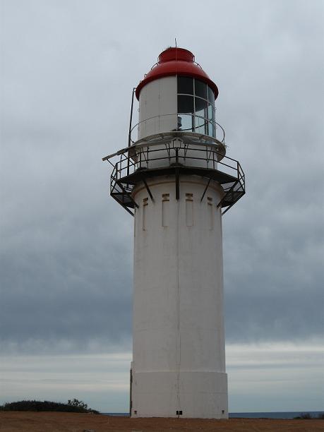
Once I got to Exmouth, I found Vlamingh Head Lighthouse. This one is also very nice. They are doing some construction to it as it has some weather damage.


“North-West Cape was first sighted in 1618 and Vlamingh Head was charted by Willem de Vlamingh in 1696. The Vlamingh Head Lighthouse was built in 1911-12 of concrete and contains a “Chance Bros” (Birmingham, UK) pre-fabricated lantern, which was decommissioned in 1967 with the opening of the Harold E. Holt Naval Base.”


“Wrecked by cyclone February 1945. Shipping in Exmouth Gulf was bombed by Japanese aircraft on three nights in May 1943.”

Although it’s the same day, the Indian Ocean was a bit more colorful here. It was still quite cloudy, but the sun was trying to peak through.
As my next lighthouse is a 6.5 hour drive, and I am tired, I’m spending the night in Exmouth. I’m hoping to go to sleep in the next hour (at 10pm or so) and then wake refreshed to drive to Karratha and the lighthouse there. If I’m not mistaken, tomorrow will be the last lighthouse in WA for me to see. (I did have to skip quite a few as there are so many on inaccessible islands!! Darn it!! But after tomorrow, I’m going to continue my journey (or walkabout as Lenny called it) to see some sights I’d like to see. But stay tuned!

As I got to the lake (it may be a salt lake), and was driving on a winding road, I came upon the Point Quobba Lighthouse. This is overlooking some pretty treacherous waters and several blowholes. This lighthouse is still in use, to the best of my knowledge. (Today was the first day that the Indian Ocean was not 14 different shades of green and blue - I guess only when the sun is out!) But it’s still beautiful. After finding the blowholes and shooting a few photos, it was back in the car for the drive to Exmouth.


Along the drive, there are sheep and goats and cows grazing right on the side of the road. I had watched an Australian movie called Charlie and Boots on this road trip. It’s about a father who is lost after his wife’s death and so his son takes him on a road trip. They had passed through some of the same towns I did on my trip!! A very funny part in the movie is when they’re driving and a lady who’s walking yells “PIG!” They turn to look at her and are concerned why she’s calling them pigs, but when they turn around, there is a pig standing in the road! As I was driving today, I had to laugh because the sheep, goats and cows just stand in the middle of the highway!! (But no one is calling me a cow!) Also along this drive up the peninsula to Exmouth is red dirt and red hills as far as the eye can see. I passed the Tropic of Capricorn (no big welcome this time, just a sign. There was a big welcome in QLD at the tropic.) It’s pretty, but after about the first 3 hours, it was the same old same old!
At the entrance to the town of Exmouth, there is a Big Prawn. These things are so funny!!

Once I got to Exmouth, I found Vlamingh Head Lighthouse. This one is also very nice. They are doing some construction to it as it has some weather damage.


“North-West Cape was first sighted in 1618 and Vlamingh Head was charted by Willem de Vlamingh in 1696. The Vlamingh Head Lighthouse was built in 1911-12 of concrete and contains a “Chance Bros” (Birmingham, UK) pre-fabricated lantern, which was decommissioned in 1967 with the opening of the Harold E. Holt Naval Base.”


“The nearby Radar Rower (a replica) was used in WWII as an early warning system for enemy aircraft and was surrounded by 10,000 camouflaged sandbags; some bags can still be seen on site. The tower was damaged by a cyclone in 1945 and the aerial was ripped from the tower, landing where it is today.”
“Wrecked by cyclone February 1945. Shipping in Exmouth Gulf was bombed by Japanese aircraft on three nights in May 1943.”

Although it’s the same day, the Indian Ocean was a bit more colorful here. It was still quite cloudy, but the sun was trying to peak through.
As my next lighthouse is a 6.5 hour drive, and I am tired, I’m spending the night in Exmouth. I’m hoping to go to sleep in the next hour (at 10pm or so) and then wake refreshed to drive to Karratha and the lighthouse there. If I’m not mistaken, tomorrow will be the last lighthouse in WA for me to see. (I did have to skip quite a few as there are so many on inaccessible islands!! Darn it!! But after tomorrow, I’m going to continue my journey (or walkabout as Lenny called it) to see some sights I’d like to see. But stay tuned!
Saturday, August 28, 2010
Great Aussie Adventure - Day 19
It was 6.4°C (43.5°F) when I headed out of Perth this morning!! I backtracked a bit to Fremantle to find North Mole Lighthouse. This one is cute as it is painted red!! This lighthouse works with the South Mole Lighthouse across the harbour. The North Mole Lighthouse was built in 1906 although it was supposed to be built first. It took 3 years for the earthworks to settle. This lighthouse is 15 meters (49 feet) tall and is seen for 10 Nautical Miles. It is a fixed red light.


North Mole Lighthouse viewed from South Mole Lighthouse, with Wadjemup Lighthouse on far left on Rottnest Island.

Wadjemup and Bathurst Lighthhouses on Rottnest Island
From here, I could see South Mole Lighthouse, Woodman Point Lighthouse and the two lighthouses on Rottnest Island. I had seen Woodman Point Lighthouse on Monday and was going to see South Mole Lighthouse when I was done here. It was nice to see Wadjemup and Bathurst Lighthouses on Rottnest Island because I would not be seeing them on the island itself. (They were way in the distance, but I could just make them out!) The island does not allow cars, and I’d have to walk to the lighthouses, and I would not be able to do it in a day before the ferry came back (it only leaves Fremantle early in the morning and returns once at 3pm.) Darn island is to big!! The only accommodation on the island is resorts and you are required to stay at least 3 nights! So that was out, but what can you do? The current Wadjemup Lighthouse is the second lighthouse on this site. The first was Western Australia’s first lighthouse and the second lighthouse here has Australia’s first rotating beam. This lighthouse flashes every 7.5 seconds. It is 80.5 meters (264 feet) above seal level, is 38.7 meters (127 feet) tall and is visible for 26 Nautical Miles. Originally the island was settled by Europeans in 1831, but was taken over by the Government in 1839 and used as an Aboriginal penal colony. The first lighthouse was completed in 1849, built by Aboriginal convicts. It took 9 years to build the 20 meter (66 feet) lighthouse, which was 3 meters (10 feet) shorter than originally planned. It was the first lighthouse to be built of stone in Western Australia. It was not operational until 1851. Originally the light flashed for 5 seconds and was seen for 18 Nautical Miles. This lighthouse was demolished in 1896 when the new lighthouse was built. The new lighthouse on Wadjemup Hill (in the center of the island) was twice as tall and had a more powerful lamp. (The designer of the this lighthouse was the same one who designed the Cape Leeuwin Lighthouse.) It was built of limestone found in the near by cove. The light was made semi-automatic in 1936 and then converted to fully automatic in 1986. The lighthouse was demanned in 1990.
The other light on the island is Bathurst Lighthouse. This lighthouse is on the Northeast corner of the island. It is a subsidiary light to the Wadjemup Hill Lighthouse. It was built in 1900 from local limestone and is a result of many shipwrecks in 1899. It has a group flashing four times every 16 seconds. It is 30 meters (98 feet) above sea level, is 19.2 meters (63 feet) tall and is visible for 24 Nautical Miles. It is painted white and has a gold dome. It was demanned in 1920 and became fully automatic in 1986. (I am disappointed that I couldn’t see these after reading about them, but there you go!!)


I then drove around the harbour and arrived at South Mole Lighthouse. (I’m sure that in a boat, it would take 3 or 4 minutes, but in a car, it took 20!) This lighthouse is the exact height and shape etc as North Mole Lighthouse, but this one is green!! I loved it - green being my favorite color and all, (I think it brings out my eyes.) Like the North Mole Lighthouse, this one is 15 meters (49 feet) tall and is visible for 11 Nautical miles. Originally, this light was fixed green, but after 100 years of service, the light was fitted with a white occulting light in 2003. A week later, it was given the green light back.

South Mole Lighthouse from North Mole Lighthouse
Anyway, I headed back towards Perth as this is where I was going to catch the freeway North to the next lighthouse. However, I missed my exit onto the freeway and ended up back in Kings Park. I drove around the park and city trying to get out for a good 45 minutes!!! Anyway, the next time I had no problem getting on the freeway heading north!
I ended up in Guilderton and found the lighthouse there. Guilderton is on the Moore River, which empties into the Indian Ocean. Again, it was a beautiful afternoon and the water and the sky and beaches looked lovely. The Guilderton Lighthouse reminded me of the Tourbridge Hill Lighthouse in Edithburgh, SA. (Funny side note - there are not overtaking (passing) lanes on most of the highways here in WA. It is just one lane each direction. I think it’s because there are always enough flat and unwinding roads so that you can pass the trucks at any time. For some reason, I noted this a lot on my drives!)


Moore River


This lighthouse was built in 1983 and was fully automated at this time. (At this point, 40 guilder coins were found from a ship that was wrecked in 1656!) This was the last lighthouse to be built in Western Australia. This lighthouse is 77 meters (253 feet) above sea level, is 30 meters (98 feet) tall and is visible for 22 Nautical Meters. It flashes 3 times in 20 seconds. This tower was constructed using specially tapered red clay bricks. It has a 7.5 meter (24.6 feet) diameter base.
From here I started out toward Geraldton, but saw signs for the Pinnacles in the Nambung National Park. I though I’d better stop, since when will I see this again? I’m so glad I did!! This is just beautiful. The Pinnacles are limestone pillars that have developed in the dessert here over millions of years.


The best way to describe these pinnacles is to quote the signs at the national park. “Enigmas in Stone - How were the pinnacles made? How old are they? Why do they exist here in such abundant and spectacular form? In geological terms, the pinnacles are very young and scientists today are just beginning to unravel their many mysteries. The pinnacles are believed to have formed underground, possibly up to 500,000 years ago during the Ice Ages of the Quaternary period. They may have remained buried for most of this time, or have been repeatedly exposed and buried again over the millennia. Evidence suggests that they were exposed around 6,000 years ago, but were again covered by shifting sands until only a few hundred years ago.
“From dune - Scientists believe that the story of the pinnacles begins off shore, where shell fragments break down to form fine-grained sand rich in calcium carbonate (lime). At the water’s edge, beach sands accumulate as a mixture of shell-based sands from the ocean floor and quartz sands carried by the rivers from the hinterlands. Blown by strong winds, the beach sands form extensive dunes along much of the coastline.
“… to limestone - As rainwater comes into contact with the dune sands, it dissolves the calcium carbonate grains. As the dunes dry out, the calcium carbonate recrystallises and cements nearby sand grains together, forming limestone. This process underlies the formation of the pinnacles.
“… to pinnacle - Just how limestone formed in the shape of pinnacles continues to puzzle scientists. Current research favours two explanations. In both, plants act as a critical catalyst. Both also remain controversial and may be challenged as new research takes place.”


Pinnacles with the ocean in the background


And from this desert national park, you can see the ocean! It just blows my mind. There is a 4km (2.5 miles) drive through the park, but this 4 kms took me 2 hours!! I would get out of the Pajero every little parking area to walk around and look at the different size and shapes of the pillars. I was going to leave, but one of the park rangers said that a lot of people stay for sunset and since it was 5pm, I thought I should stay. And then I thought, I didn’t have a hotel room booked yet and I didn’t want any problems like I did over the weekend, and I was hungry. So I headed to the restroom again before the long drive to the next stop, and then I headed back out to the 4km drive to watch the sunset. I know, I know, I’m very indecisive!!! But it was a great sunset over the Indian Ocean and interesting to see the limestone pillars in different lighting.


Duck Pinnacle


Kangaroo!! (Well the back half anyway!)


You can almost see me in photo above right.


Then I drove like a crazy person to Dongara to find a hotel and a bite to eat. I got in at 7:30pm and was so glad as a lot of hotel receptions close at 8pm. But the hotel has a great tavern attached to it and I had a delicious burger and beer. (Good thing too since when I was out with Carrieann and Paul on Monday, we were going to have Chinese or pub food, and since we had Chinese, I’d been craving a burger, and this huge one hit the spot!) While I was waiting for dinner, I looked through a local travel brochure and found out what I’m going to do in the morning before heading up to the lighthouse in Geraldton! Stay tuned!
P.S. TT - this journey to Dongara in the dark reminded me of the time you and I were driving to Seattle and you were driving during the night through Wyoming and the deer! But here it’s roos, rather than deer.


North Mole Lighthouse viewed from South Mole Lighthouse, with Wadjemup Lighthouse on far left on Rottnest Island.
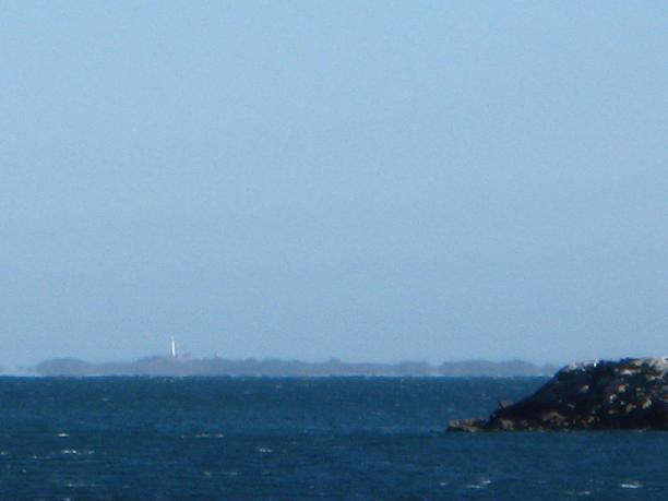
Wadjemup and Bathurst Lighthhouses on Rottnest Island
From here, I could see South Mole Lighthouse, Woodman Point Lighthouse and the two lighthouses on Rottnest Island. I had seen Woodman Point Lighthouse on Monday and was going to see South Mole Lighthouse when I was done here. It was nice to see Wadjemup and Bathurst Lighthouses on Rottnest Island because I would not be seeing them on the island itself. (They were way in the distance, but I could just make them out!) The island does not allow cars, and I’d have to walk to the lighthouses, and I would not be able to do it in a day before the ferry came back (it only leaves Fremantle early in the morning and returns once at 3pm.) Darn island is to big!! The only accommodation on the island is resorts and you are required to stay at least 3 nights! So that was out, but what can you do? The current Wadjemup Lighthouse is the second lighthouse on this site. The first was Western Australia’s first lighthouse and the second lighthouse here has Australia’s first rotating beam. This lighthouse flashes every 7.5 seconds. It is 80.5 meters (264 feet) above seal level, is 38.7 meters (127 feet) tall and is visible for 26 Nautical Miles. Originally the island was settled by Europeans in 1831, but was taken over by the Government in 1839 and used as an Aboriginal penal colony. The first lighthouse was completed in 1849, built by Aboriginal convicts. It took 9 years to build the 20 meter (66 feet) lighthouse, which was 3 meters (10 feet) shorter than originally planned. It was the first lighthouse to be built of stone in Western Australia. It was not operational until 1851. Originally the light flashed for 5 seconds and was seen for 18 Nautical Miles. This lighthouse was demolished in 1896 when the new lighthouse was built. The new lighthouse on Wadjemup Hill (in the center of the island) was twice as tall and had a more powerful lamp. (The designer of the this lighthouse was the same one who designed the Cape Leeuwin Lighthouse.) It was built of limestone found in the near by cove. The light was made semi-automatic in 1936 and then converted to fully automatic in 1986. The lighthouse was demanned in 1990.
The other light on the island is Bathurst Lighthouse. This lighthouse is on the Northeast corner of the island. It is a subsidiary light to the Wadjemup Hill Lighthouse. It was built in 1900 from local limestone and is a result of many shipwrecks in 1899. It has a group flashing four times every 16 seconds. It is 30 meters (98 feet) above sea level, is 19.2 meters (63 feet) tall and is visible for 24 Nautical Miles. It is painted white and has a gold dome. It was demanned in 1920 and became fully automatic in 1986. (I am disappointed that I couldn’t see these after reading about them, but there you go!!)


I then drove around the harbour and arrived at South Mole Lighthouse. (I’m sure that in a boat, it would take 3 or 4 minutes, but in a car, it took 20!) This lighthouse is the exact height and shape etc as North Mole Lighthouse, but this one is green!! I loved it - green being my favorite color and all, (I think it brings out my eyes.) Like the North Mole Lighthouse, this one is 15 meters (49 feet) tall and is visible for 11 Nautical miles. Originally, this light was fixed green, but after 100 years of service, the light was fitted with a white occulting light in 2003. A week later, it was given the green light back.

South Mole Lighthouse from North Mole Lighthouse
Anyway, I headed back towards Perth as this is where I was going to catch the freeway North to the next lighthouse. However, I missed my exit onto the freeway and ended up back in Kings Park. I drove around the park and city trying to get out for a good 45 minutes!!! Anyway, the next time I had no problem getting on the freeway heading north!
I ended up in Guilderton and found the lighthouse there. Guilderton is on the Moore River, which empties into the Indian Ocean. Again, it was a beautiful afternoon and the water and the sky and beaches looked lovely. The Guilderton Lighthouse reminded me of the Tourbridge Hill Lighthouse in Edithburgh, SA. (Funny side note - there are not overtaking (passing) lanes on most of the highways here in WA. It is just one lane each direction. I think it’s because there are always enough flat and unwinding roads so that you can pass the trucks at any time. For some reason, I noted this a lot on my drives!)


Moore River


This lighthouse was built in 1983 and was fully automated at this time. (At this point, 40 guilder coins were found from a ship that was wrecked in 1656!) This was the last lighthouse to be built in Western Australia. This lighthouse is 77 meters (253 feet) above sea level, is 30 meters (98 feet) tall and is visible for 22 Nautical Meters. It flashes 3 times in 20 seconds. This tower was constructed using specially tapered red clay bricks. It has a 7.5 meter (24.6 feet) diameter base.
From here I started out toward Geraldton, but saw signs for the Pinnacles in the Nambung National Park. I though I’d better stop, since when will I see this again? I’m so glad I did!! This is just beautiful. The Pinnacles are limestone pillars that have developed in the dessert here over millions of years.


The best way to describe these pinnacles is to quote the signs at the national park. “Enigmas in Stone - How were the pinnacles made? How old are they? Why do they exist here in such abundant and spectacular form? In geological terms, the pinnacles are very young and scientists today are just beginning to unravel their many mysteries. The pinnacles are believed to have formed underground, possibly up to 500,000 years ago during the Ice Ages of the Quaternary period. They may have remained buried for most of this time, or have been repeatedly exposed and buried again over the millennia. Evidence suggests that they were exposed around 6,000 years ago, but were again covered by shifting sands until only a few hundred years ago.
“From dune - Scientists believe that the story of the pinnacles begins off shore, where shell fragments break down to form fine-grained sand rich in calcium carbonate (lime). At the water’s edge, beach sands accumulate as a mixture of shell-based sands from the ocean floor and quartz sands carried by the rivers from the hinterlands. Blown by strong winds, the beach sands form extensive dunes along much of the coastline.
“… to limestone - As rainwater comes into contact with the dune sands, it dissolves the calcium carbonate grains. As the dunes dry out, the calcium carbonate recrystallises and cements nearby sand grains together, forming limestone. This process underlies the formation of the pinnacles.
“… to pinnacle - Just how limestone formed in the shape of pinnacles continues to puzzle scientists. Current research favours two explanations. In both, plants act as a critical catalyst. Both also remain controversial and may be challenged as new research takes place.”


Pinnacles with the ocean in the background


And from this desert national park, you can see the ocean! It just blows my mind. There is a 4km (2.5 miles) drive through the park, but this 4 kms took me 2 hours!! I would get out of the Pajero every little parking area to walk around and look at the different size and shapes of the pillars. I was going to leave, but one of the park rangers said that a lot of people stay for sunset and since it was 5pm, I thought I should stay. And then I thought, I didn’t have a hotel room booked yet and I didn’t want any problems like I did over the weekend, and I was hungry. So I headed to the restroom again before the long drive to the next stop, and then I headed back out to the 4km drive to watch the sunset. I know, I know, I’m very indecisive!!! But it was a great sunset over the Indian Ocean and interesting to see the limestone pillars in different lighting.


Duck Pinnacle


Kangaroo!! (Well the back half anyway!)


You can almost see me in photo above right.


Then I drove like a crazy person to Dongara to find a hotel and a bite to eat. I got in at 7:30pm and was so glad as a lot of hotel receptions close at 8pm. But the hotel has a great tavern attached to it and I had a delicious burger and beer. (Good thing too since when I was out with Carrieann and Paul on Monday, we were going to have Chinese or pub food, and since we had Chinese, I’d been craving a burger, and this huge one hit the spot!) While I was waiting for dinner, I looked through a local travel brochure and found out what I’m going to do in the morning before heading up to the lighthouse in Geraldton! Stay tuned!
P.S. TT - this journey to Dongara in the dark reminded me of the time you and I were driving to Seattle and you were driving during the night through Wyoming and the deer! But here it’s roos, rather than deer.
Subscribe to:
Posts (Atom)
About Me

- Laura
- Denver, Colorado, United States
- I'm originally from Colorado, but I've been living in Australia for three years. Before that, I lived all over the U.S.: Washington State, Maine, California, Oregon, Nebraska, North Carolina, Arizona, New Mexico, Pennsylvania, and more... No, I'm not a military brat or a military wife; I was a traveling nurse for 5 years so I moved to a new city every 3 months. During my travels, I became intrigued with lighthouses and started making plans to photograph as many as I could in whichever state I was living (including the two in Nebraska!) My blog is about my trips to various lighthouses, as well as other interesting trips. I hope you enjoy reading, and leave a comment or two!