Great Aussie Adventure - Day 10


The Troubridge Island Lighthouse in on the Investigator Strait between Kangaroo Island and the Yorke Peninsula. This lighthouse was needed as there were between 33 and 100 shipwrecks and groundings this area. In 1850, there were seven vessels that ran aground in an eight-month period. This lighthouse, built in 1855, was South Australia’s second lighthouse. It was constructed of cylindrical cast iron segments that was shipped out from the UK and bolted together on the island. The keepers cottages were completed in 1856. In 1889, the light was upgraded to a fixed red light. Between 1925 and 1931, electricity was provided by a petrol generator. In 1956, the light was again upgraded that increased the range from 10 Nautical Miles to 25. In this same year, the light was repainted bright red with a white horizontal band as its daymark. In the late 1970’s, it was decided to build the Troubridge Hill Lighthouse. The Island Lighthouse was downgraded, automated and demanned, with the new light. The light was extinguished in March 2002 and replaced by a beacon at Marion Reef. Also in March 2002, Troubridge Island Lighthouse was given the honor of being on a postage stamp. In 1802, the island was a sandbar on a limestone reef, and by 1838, it was a small inlet that was 600 meters (1,969 feet) long by 300 meters (984 feet) wide. Although it is now 800 meters (2,625 feet) long by 400 meters (1,312 feet) wide, it is erosion that is threatening the lighthouse now, as the edge of the island is currently right up the base of the lighthouse. The lighthouse has withstood an earthquake in 1902 which caused a fire to destroy the lantern room and damaged the foundations. The lantern room was repaired at this time for immediate service, but it was not until 1904 that the tower foundations and cottages were repaired. Because of the land erosion, there are no tours of the lighthouse or the island. This light flashes every 10 seconds, red and white. The red is visible for 7 Nautical Miles, while the white is seen for 10 Nautical Miles. It is 25 meters (82 feet) above sea level and is 24 meters (79 feet) tall.


The Troubridge Hill Lighthouse was built in 1980 to replace the Troubridge Island Lighthouse. This lighthouse is unique in that is was built from special wedge shaped clay bricks and has never been rendered or painted and the lantern room is fabricated fiberglass. Because of the wedge shaped bricks, this lighthouse is earthquake proof and was built to resist high winds. This light was built to be automatic and unmanned as the original apparatus was an array of sealed beam lanterns (like car headlights) that turned. However, this was expensive, so they were replace with a rotating lens and electric lantern. This lighthouse flashes twice in 15 seconds. It is 62 meters (203 feet) in elevation, is 32 meters (105 feet) tall and is visible for 22 Nautical Miles.

There was a big storm coming in and as I was leaving the lighthouse, the rain came.

But then it cleared up later as I was wandering around Innes National Park. In this park, I knew about 3 lighthouses, but there is actually 5!! Of the 3, I thought I could only see 2, but in fact I could see 4. Anyway, since this is a national park, there were signs all over telling drivers to watch out for emus, kangaroos and osprey. It was so weird, but I did see wild emus grazing and even 3 kangaroos hopping across the road! And one or two osprey in the air. It was great!

Here I saw Althorpe Island Lighthouse (in the distance on the island) and Cape Spencer Lighthouse. Built in 1879, the lighthouse on Althorpe Island was kept working by dedicated lighthouse keepers for 112 years until 1991 when it became automated. Lighthouse keepers brought goats, cats, sheep, wallabies and even a horse to the island, along with introduced weeds. To protect the native plants and animals, the island became a conservation park in 1972. (1972!!) Since then, volunteers and park staff have been removing the feral plant and animals from the island. Some of the volunteers even manned the lighthouse before it was automated. The island in 91.5 hectares in area, 1.6 km (0.99 miles) from North to South, 1.2km (0.75 miles) wide and is 91 meters (299 feet) above sea level. (Port Lincoln is 32 Nautical Miles further west - but it took me a full day to drive to Port Lincoln!!) The construction was begun in 1877, but it was not until February 14, 1879 that the light was lit and the 3 keepers cottages were finished. The lighthouse was built of limestone and hard sandstone found on the island. The spiral staircase was constructed of solid bricks of sandstone. The keepers cottages were also made from the hard and limestone found on the island. Although the lighthouse was in place, six shipwrecks were noted between 1877 and 1982. This lighthouse was originally powered by oil followed by acetylene gas and then converted to electric in 1963. It was finally converted to solar in 1991. Althorpe Island Lighthouse is 107 meters (351 feet) above sea level, is 20 meters (66 feet) tall and is visible for 24 Nautical Miles. It flashes for 0.1 second every 7 seconds.

The Cape Spencer Lighthouse was originally placed in Innes National Park in 1950 as an automatic light that was similar to a metal box with a river-style light on top. Then in 1970 it was upgraded to the current concrete lighthouse. This 1970’s lighthouse also replaced Althorpe Island Lighthouse. This light flashes three times every 15 seconds. It is 78 meters (259 feet) above sea level, is only 9 meters (30 feet tall) and can be seen for 23 Nautical Miles.
Cape Spencer and Althorpe Island

I had written on my trip planner that I couldn’t see West Cape Lighthouse, but since I was there, I drove to the area just in case. And wouldn’t you know it, I COULD see it!! It is very shiny!! It is called Simplex Munditiis which means “Elegant Simplicity” in Latin. It was built using stainless steel to minimise environmental impact during construction. This one was built in 1980! It is 8.5 meters (28 feet) tall.


 Pondalowie Bay Lightouse
And from here, I could see Wedge Island, but not the lighthouse on it as it’s too far away, and Pondalowie Bay Lighthouse, which is on South Island. The lighthouse on Wedge Island is only 5 meters tall, but is the highest above sea level in Australia at 206 meters. It was built in 1911. The Royal Australian Air Force installed a radar station on Wedge Island during World War II. Up to 50 men lived there, watching for enemy ships.
And the last thing I saw in Innes National Park was a funny little island called Chinaman’s Hat. I’m not exactly sure where the name came from, but if you squint your eyes and turn your head, you might be able to see a Chinaman’s Hat!!!!
After leaving Innes National Park, I drove to Corny Point and found the lighthouse there. I took the long winding road to the lighthouse along a long dirt road that ran along the coast. It was so pretty with the sun breaking through the clouds and the ocean and fields. Then there was Corny Point Lighthouse, of course.

The Corny Point Lighthouse was first lit on 1st of March 1882. It was attended by light keepers until 1920 when the light was converted to automatic acetylene and in 1978 converted to electrical operation. The range of the light is 35km (19 Nautical Miles). This lighthouse is located on the northernmost point of the foot of the Yorke Peninsula. It was originally built to protect the grain ships entering Port Victoria, Moonta Bay and Wallaroo in the Spencer Gulf. It’s other purpose was to protect the southbound windjammers that were endangered by sou-westers which could bring them in on the Web Rock or onto the reefs and shoals of Berry Bay and Daly Head. There were two sites chosen for the lighthouse, one on top of the hill and the other on a rise closer to the sea. The second site was chosen although it was less stable. Because of this, a large concrete base was constructed. The tower was built from local limestone. There were two keepers cottages built from local stone as well. The original light was a twin wick burner which used mineral oil. It was automated in 1920 and the keepers cottages and stores were demolished. A 240 volt mains powers was connected in 1978 to increase the power, but it was so powerful that it caused problems with reflection of white light over Web Rock and the red screen had to be adjusted again. The first time this problem occurred was with the first light keeper, when he noticed the lighthouse was not in proper working order. The white light was shining over Web Rock causing a shipping hazard. J. Dagweill, the first light keeper, placed a canvas screen so it covered the reef side and this seemed to help. This lighthouse is 30 meters (16 feet) above sea level, is visible for 19 Nautical Miles and is 16 meters (8.6 feet) tall. The light flashes four times in 20 seconds.
There are some interesting notes from the keepers log - 27th August 1888 - At 3.30 a.m. observed a most brilliant meteor to northward about 45 deg above the horizon like a fiery globe falling to within about 25 deg of the sea apparently exploding. Having a tail of light like a comet. The whole display lasting about 10 seconds and lighting up the whole district.


It was blowing a gale here and it was so cold with the rain starting again, so I hopped back in the car and drove to Wallaroo where I saw the lighthouse that was removed to the maritime museum. This one is the Tipara Reef Lighthouse. This lighthouse was necessary because Tipara Reef was hazardous to ships as it was only one meter of water in some areas. At first there was a lightship here, but it was unsuitable. Since Wallarroo and Moonta were so important as trade ports, the government agreed to place a lighthouse here in 1872. It was completed in 1877. Originally, the lighthouse was erected on screw piles driven three meters into the reef. A platform was constructed and a wrought iron tower was placed on top. It had two decks and was over 30 meters (98 feet) above sea level. The main deck had a watch room, keepers quarters, kitchen, workshops and water tanks. According to a sign near the museum in Wallarroo, The lighthouse is entrusted to four keepers three of who are always on duty at the light, while a fourth resides at Moonta Bay to keep up a shore watch and private means of communication and supply with the mainland. The shore watch is not, however, a monopoly, each keeper in turn taking one month’s land duty to three months in the lighthouse. Supplies and correspondence are bought from Moonta Bay once a week by the keeper on shore duty in a fine sailing boat which forms part of the equipment of the lighthouse, and a dingey is also provide in which the keepers can take short marine excursions for the purpose of varying their regulation fare with a fish diet. South Australain Register, 5 January 1884. The original lighthouse optics consisted of a single white flashing light but a red section was added in 1917. In 1920, the lighthouse was de-manned and the oil-fuelled lantern was replaced by an automatic light. In 1968, all of the original accommodations and associated fittings were removed. The light section was removed from the pylons in 1955 and relocated to this site (the museum.)
And then I drove to Kadina where I’m spending the night. It sure is cold here on the ocean, but today is the last day of fall, so I guess it’s to be expected!! But 8 lighthouses in one day is pretty darn good!!!
Great Aussie Adventure - Day 9


From here, I drove to Cape Jervis through the Murray River wine region. This winery and inn was so cool that I actually turned around 10 minutes after I passed it, so that I could get a photo of it!

When I got to Cape Jervis, it was still raining, but the lighthouse there was nice. It reminded me of the Robe Lighthouse, maybe because it was also built in 1972!! (Good year for lighthouses and for Laura - and for you too Michael!!)


I copied the following from a sign: “Site of the original Cape Jervis Lighthouse - This plaque marks the base of the original lighthouse which was built in 1871. The tower was 23ft high and was fitted with a kerosene wick burner lamp shown on the 10th of August 1871 and was visible for 10 miles. Two lighthouse keepers lived in nearby cottages. In 1910 the kerosene wick burner lamp was replaced with an incandescent kerosene vapour apparatus having an intensity of 3000 candela. In 1927, the lighthouse was converted to an automatic acetylene gas unit flashing a white light of 4500 candela. The two lighthouse keepers were withdrawn. A new lighthouse with an automatic electric light of 41000 candela was erected nearby in 1972.” You can actually see the original base next to the new lighthouse in the second photo above!!
Cape Jervis is where the ferry is that goes to Kangaroo Island. There are four lighthouses on Kangaroo Island, but it was going to cost $60 for me to get the island, $60 to get the car there, and than another $120 for the return ferry ride. So I left Cape Jervis and Kangaroo Island behind (with my $240). (This does not include the fuel for me and the car and hotels!!)

 Kangaroo Island
I drove for about an hour to Adelaide. Here I saw Marino Lighthouse. I think this is the lighthouse that Lisa and I saw in November when we were swimming with the dolphins. It was raining when I was here, so I left quickly. However, out in the Southern Ocean, there was a break in the clouds and the sun was shining on the water is a few spaces only. Very weird. I just kind of stumbled onto this lighthouse, I knew the general direction, but then, I looked up and there was the lighthouse! Then I ended up getting turned around leaving this lighthouse and driving around Adelaide instead of through Adelaide like I had planned and somehow ended up a Port Adelaide Lighthouse. I was glad it all worked out like this.


The Port Adelaide Lighthouse was built in 1869. First erected at the entrance to the Port River, this attractive marine signal was re-erected on South Neptune Island in 1901. The lighthouse was dismantled in 1985 and placed on its present site in 1986. It is now located within the maritime museum. I skipped this museum since we all know what happened last time I stopped at a maritime museum!!!


Since I had skipped my day and half trip to Kangaroo Island, and it was 3pm when I was done at Port Adelaide, I decided to drive towards the next lighthouse and was going to stop when it got dark and find a place to stay and eat. (I drove through Dublin!) But then, when it was dark, there was not really any where to stop, just hostels, and we all know I don’t like these, so I ended up driving until 7:30pm to Edithburgh. But it’s ok, there are two lighthouses for me to see in the morning. Since it was dark, when I got here, the moon was out. I remembered that it was the full moon when I was leaving Victoria, but because it was so overcast and cloudy every night, I couldn’t see the moon. But tonight it was breaking through the clouds and was very big and orange. It was cool!! But since I was tired and just wanted to get to the hotel, I didn’t stop to try to photograph it. Plus, it was so dark, there are no street lights on these back roads on the Yorke Peninsula, so I just kept driving, luckily there wasn’t really any wildlife on the roads, just mice and kangaroo rats crossing the street!
Great Aussie Adventure - Day 8 - State 3


Lake Brown and Leg of Mutton Lakes have been long ago filled in and now huge trees and grass are where the lakes used to be.


In the area is also Century Tower. This was a nice tower, but it was closed and because there was so much fog and mist and rain, (and it was a steep climb to the tower), I did not hike up to it. This tower was opened in 1904 and was built to commemorate the 100 years since Mount Gambier was sighted and named by Lt James Grant aboard “The Lady Nelson”.


I then drove to Carpenter Rocks and saw Cape Banks Lighthouse. It is a very orange lighthouse, but very cute. And the surrounding cliffs and water was so pretty. It was so stormy and gray, but still very cool! (I was kind of wishing it was a blue sky - Denver Bronco colors, but you can’t have everything!)

This lighthouse is special in that it is one of three lighthouses left with a 14-sided Deville lantern room. Of course there are no tours of this lighthouse, so I couldn’t see what they were talking about!! This lighthouse was built in 1883. Originally it was 7.5 meters (25 feet) tall and was made of local limestone. The lantern was used from the old MacDonnell Lighthouse at Cape Northumberland when it was demolished in 1882. It was an alternating revolving, one red and two white flashes. It had only two keepers’ quarters a shed, a store and the light itself. The buildings were all separate, with the residences located ‘below’ the lighthouse in a depression, presumably to provide some degree of protection from the elements. In 1928, it was increased to 15 meters (49 feet) tall. At this time the light was demanned and the keeper’s cottage demolished. In 1976, the light was converted to electricity using the lens from St. Francis Island. This lighthouse is 27.6 meters (91 feet) above sea level and is seen for 15 Nautical Miles.

This lighthouse was necessary due to one especially bad ship wreck in 1859. “The Admella was the finest steamer of the Australian coasting fleet in 1859. It was carrying 113 people on this voyage, destined to be its last. Some were travelling to the Victorian goldfields, some to family reunions, and some to a Melbourne horse race. Most would never reach their destinations. Below is a fragment of time from the eight days that the survivors clung to the wreck.
“Friday, 5 August 1859 - Admella stands off at Glenelg to allow for any leaving or joining passengers…there are none…continues down Gulf of St Vincent…
”Saturday, 6 August - …5am, foggy, cold and like the teeth of a saw, Carpenter Rocks breaks Admella into three sections, one mile from shore. Shocked passengers cling to the rigging in their night clothes; others are washed away…three desperate attempts to reach the shore fail…
”Sunday, 7 August - …two children drown, strapped to their father’s back as he attempts to haul himself from the bow to the safer aft section, fifteen succeed. After three hours on a raft, two reach the shore and stumble off for help…
”Monday, 8 August - …Many suffering from exposure, with swollen and painful limbs…three thimblefuls given to each survivor of desiccated milk, currants and brandy. News of the disaster finally reaches the Adelaide Post Office…
”Tuesday, 9 August - …rescuers arrive on the beach. Almonds distributed on the wreck…many chew strips of lead to ease their thirst….a screaming survivor dives into the sea, having drunk seawater…more die quietly during the night, rolling off the deck or dropping from the rigging…
”Wednesday, 10 August - …less than half remain…sea conditions worsen…some wait for death with glazed eyes; others talk of worldly possessions. The shore party repair one of Admella’s washed up boats with soap and canvas and try to gain to reach the vessel. People die through out the day. The steamer Corio arrives…
”Thursday, 11 August - …rescue attempts by the shore party and Corio’s pilot boat fail. More die of cold and starvation, including two or the three remaining women. More rescuers arrive on the beach, swelling the number to over one hundred…
”Friday, 12 August - …Corio departs for more coal. The Ant and the Lady Bird arrive, towing the Portland lifeboat and a whale boat. Survivors described as ‘looking like seals perched on a rock’…almost beyond caring and too weak to assist in the first rescue attempts…many vow to not live past the next afternoon. Thirty remain…
”Saturday, 13 August - …thoughts of cannibalism…thoughts of suicide…more die during the night. Two rescue boats from shore reach Admella - a line is thrown, and four survivors drag themselves along it…three survive. Boats from the waiting vessels arrive…and those remaining also find the strength to lower themselves down a line to safety. Twenty four survived the wreck.
”Postscript - Hurtle Fisher, one of the passengers who survived the ordeal lost almost 22kg (48.5 pounds) in body weight. His horse named “The Barber”, one of six horses on board survived. On 2 October 1859, “The Barber” ran in the inaugural Championship Sweepstake in Melbourne. Although it didn’t win the race, it was know as a “champion swimmer”.
And then off to Beachport to find Cape Martin Lighthouse and Penguin Island Lighthouse. Penguin Island lighthouse is no longer in use. In fact there is not even a light on top. The island is inaccessible, even by boat, as it is now a bird sanctuary. This lighthouse was built on the island in 1878. There were two lighthouse keepers stationed on the island. The original light was third order Chance Brothers with a wick burner powered mineral oil. In 1909, an incandescent apparatus was used, and then in 1918, it was converted to acetylene gas and demanned. In 1960, the light was extinguished and re-established at Cape Martin on the mainland.


Cape Martin Lighthouse has the lantern from the Penguin Island Lighthouse. Originally, this lighthouse was 4.5 meters (15 feet) tall, but this was not tall enough to be seen from the ocean, as the surrounding sand dunes obscured the light. In 1974 the lantern was converted to electricity and in 1980, the tower was raised to 12 meters using precast concrete slabs. This lighthouse is now 38 meters (125 feet) in elevation and is seen for 18 Nautical miles. It flashes every 20 seconds.


I walked around Beachport (it had stopped raining by this point) and looked at the cute town. (The red car in the second photo is my car!!)


My next stop was Robe. (They’re not famous for Robes.)

I saw the lighthouse here, it is a very modern lighthouse as it was built in 1972 - a very good year!! It was quite modern looking though, not like the usual lighthouses. But judge for yourself. It is a star-shaped lighthouse was built as an automated unmanned light to replace the Cape Jaffa Lighthouse. It is 3.5 meters (11 ½ feet) wide at the bottom and slants towards 5 meters (16 feet) wide at the top. It stands at an elevation of 63 meters (207 feet), is 19 meters (62 feet) tall and is seen for 20 nautical miles. It has a group flash 3 times every 10 seconds.


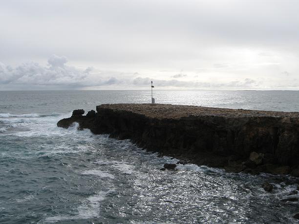
In Robe, I also saw an old goal (jail) ruins, interesting rocks out in the ocean, The Obelisk and some cute churches. The Obelisk was built to store rockets fired to distressed ships carrying life lines and baskets for bringing passengers ashore. It was originally painted white, but it blended in with the limestone cliffs, so it was repainted red and white. It’s an interesting structure. The sinking of the Admella played an important part in the history of the goal. “In contrast an official bungle at this goal was put right by the remains of the ill fated Admella. There was concern about the standard of workmanship when the goal was built: two early prisoners picked their way through the walls using a hook made from light winder fastening. The prisoners were soon caught but the escape led to the reinforcement of the cells’ walls with boiler plates salvaged from the wreck of the Admella.” Near the Obelisk, there was an small light on a steel pole, I’m not sure what it is, but you can decide for yourself what it might be.




From Robe, I headed west towards Cape Jaffa. I drove to Cape Jaffa along the water as the lighthouse platform is supposed to be visible from here, but I sure could not find it. So I drove to Kingston S.E. where the Cape Jaffa lighthouse had been relocated. Originally, this lighthouse was built on Margaret Brock Reef off Cape Jaffa, as a pile light in 1872. At first, there was a multi-wick oil burner, but was replace by a pressurised kerosene burner in 1909. This lighting apparatus was turned off in 1973 and is believed to have been the last of its type to operate in Australia. This type of lighthouse is know as ‘Wells Screw Pile‘. This lighthouse was built in England, dismantled, shipped to Australia and then constructed on Margaret Brock Reef. It took 3 years to reconstruct rather than the proposed 1 year. The weather was calm when the site was chosen, but during the time of construction, the seas were wild. Some of the parts were washed away and contractors could not do any work for a few days. This lighthouse was not manned, and 1972, with the construction of the Robe Lighthouse, this was closed. The lighthouse was moved to Kingston and turned into a museum in 1976. While still in use, the light flashed 5/10 of a second every 3 ¾ seconds. It was 41 meters (135 feet) above sea level, was 41 meters tall and seen for 16 Nautical Miles.


There is a museum here, but my camera battery died and I would not have been able to get photos inside, so I just got photos of the lighthouse and then off to find batteries. Also in Kingston S.E. is another Big Thing. A Lobster. I originally thought the Big Thing I saw in Stanley, Tasmania was a lobster, but realize now that the first one must have been a prawn, or some other kind of shellfish! But that’s not important. This lobster is truly a big thing!!

And then I drove to Murray Bridge where I am spending the night. The drive was really pretty with rainbows and sunset orange and pink and amazing cloud formations! (The sunset and clouds were orange and pink, the rainbows were the colors of a rainbow!) And it was also pretty with all the cows and sheep grazing in the green grass as the sun was breaking through the clouds!
Oh, I stopped in Meningie because I needed some caffeine for the last hour of my drive and I saw a post card with the Point Malcolm Lighthouse on it!!! I added 3 exclamation points because the Point Malcolm Lighthouse is on private property and is inaccessible to the public! But now, I have a photograph postcard of it! Excellent! It is the only lighthouse that is inland in the Southern Hemisphere. It was built in 1878 between Lake Alexandria and Lake Albert, opposite Narrung which is a small Aboriginal community. This lighthouse was built to assist ships passing through Lake Alexandria on the way to Lake Albert or the ports of the Murray River. The light was turned off in 1931 as there was less river traffic. An automatic light on a steel pole was installed next to the old tower, to guide any ships using the old route. This light revolved with a flash every 10 seconds and then was altered to a fixed white light in 1887. It is 25 meters (82 feet) in elevation, is 7 meters (23 feet) tall and has a range of 10 kilometres. (I’m not sure if they use Km’s here rather than nautical miles because it is inland?)
 Labels:
Australia,
Cape Banks,
Cape Jaffa,
Cape Martin,
Lighthouse,
Mount Gambier,
Penguin Island,
Robe,
South Australia
|
 0
comments
About Me

- Laura
- Denver, Colorado, United States
- I'm originally from Colorado, but I've been living in Australia for three years. Before that, I lived all over the U.S.: Washington State, Maine, California, Oregon, Nebraska, North Carolina, Arizona, New Mexico, Pennsylvania, and more... No, I'm not a military brat or a military wife; I was a traveling nurse for 5 years so I moved to a new city every 3 months. During my travels, I became intrigued with lighthouses and started making plans to photograph as many as I could in whichever state I was living (including the two in Nebraska!) My blog is about my trips to various lighthouses, as well as other interesting trips. I hope you enjoy reading, and leave a comment or two!